


BEDMINSTER TWP VTD WEST, Bucks County, Pennsylvania
About
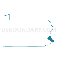
Outline

Summary
| Unique Area Identifier | 657835 |
| Name | BEDMINSTER TWP VTD WEST |
| County | Bucks County |
| State | Pennsylvania |
| Area (square miles) | 14.03 |
| Land Area (square miles) | 13.81 |
| Water Area (square miles) | 0.22 |
| % of Land Area | 98.45 |
| % of Water Area | 1.55 |
| Latitude of the Internal Point | 40.40884940 |
| Longtitude of the Internal Point | -75.21042780 |
Maps


Graphs
Select a template below for downloading or customizing gragh for BEDMINSTER TWP VTD WEST, Bucks County, Pennsylvania


Neighbors
Neighoring Voting District (by Name) Neighboring Voting District on the Map
- BEDMINSTER TWP VTD EAST, Bucks County, PA
- DUBLIN Voting District, Bucks County, PA
- EAST ROCKHILL TWP VTD 01, Bucks County, PA
- EAST ROCKHILL TWP VTD 02, Bucks County, PA
- HAYCOCK TWP Voting District, Bucks County, PA
- HILLTOWN TWP VTD BLOOMING GLEN 1, Bucks County, PA
- HILLTOWN TWP VTD HILLTOWN, Bucks County, PA
- PLUMSTEAD TWP DIST 02, Bucks County, PA
Top 10 Neighboring County Subdivision (by Population) Neighboring County Subdivision on the Map
- Hilltown township, Bucks County, PA (15,029)
- Plumstead township, Bucks County, PA (12,442)
- Bedminster township, Bucks County, PA (6,574)
- East Rockhill township, Bucks County, PA (5,706)
- Haycock township, Bucks County, PA (2,225)
- Dublin borough, Bucks County, PA (2,158)
Top 10 Neighboring Place (by Population) Neighboring Place on the Map
Top 10 Neighboring Unified School District (by Population) Neighboring Unified School District on the Map
- Central Bucks School District, PA (114,377)
- Pennridge School District, PA (48,307)
- Quakertown Community School District, PA (36,426)
Top 10 Neighboring State Legislative District Lower Chamber (by Population) Neighboring State Legislative District Lower Chamber on the Map
- State House District 144, PA (68,397)
- State House District 145, PA (65,216)
- State House District 143, PA (62,909)
Top 10 Neighboring State Legislative District Upper Chamber (by Population) Neighboring State Legislative District Upper Chamber on the Map
Top 10 Neighboring 111th Congressional District (by Population) Neighboring 111th Congressional District on the Map
Top 10 Neighboring Census Tract (by Population) Neighboring Census Tract on the Map
- Census Tract 1040, Bucks County, PA (6,574)
- Census Tract 1023, Bucks County, PA (5,706)
- Census Tract 1042.04, Bucks County, PA (4,313)
- Census Tract 1021.02, Bucks County, PA (3,129)
- Census Tract 1033, Bucks County, PA (2,225)
- Census Tract 1041, Bucks County, PA (2,158)
Top 10 Neighboring 5-Digit ZIP Code Tabulation Area (by Population) Neighboring 5-Digit ZIP Code Tabulation Area on the Map
- 18951, PA (34,651)
- 18944, PA (24,479)
- 18902, PA (20,973)
- 18947, PA (6,172)
- 18942, PA (3,260)
- 18917, PA (2,158)
- 18923, PA (998)